
Palavras-chave
Análise de Sensibilidade
Mobilidade Infantil
Cidades para Crianças
Geoprocessamento
Como Citar


Resumo
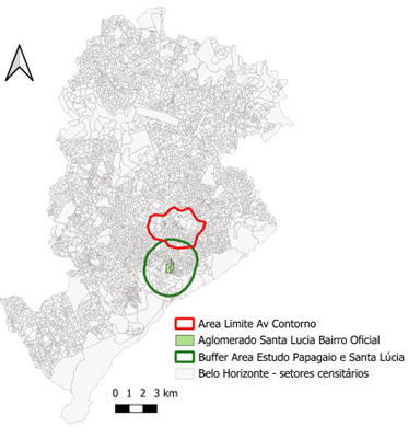
O artigo relata o emprego de tecnologias de geoinformação como suporte à análise espacial de adequabilidade de vias urbanas para a mobilidade infantil independente, com vistas a entender as diferenças de oportunidades entre áreas da cidade planejadas e áreas não planejadas, sendo as segundas em um exemplo de vulnerabilidade social. Os estudos de caso são desenvolvidos em áreas conectadas em Belo Horizonte, sendo a primeira a cidade tradicional projetada e a segunda um recorte de uma favela e seus arredores. Explora modelos de Análise de Multicritérios por Pesos de Evidência (Multicriteria Analysis) e de Análise de Sensibilidade para Avaliação de Adequação (Sensitivity Analysis to Suitability Evaluation). A partir da escolha criteriosa de variáveis de análise, apoiado por ampla revisão bibliográfica sobre o tema, são elaborados mapas temáticos que caracterizam cada condição de ocupação, segundo características físicas, presença de infraestrutura, tipologias de uso, ocupação humana do espaço. Uma vez elaboradas as variáveis iniciais, elas são integradas para espacialização do nível de vulnerabilidade espacial, e são avaliados os níveis de incerteza das distribuições espaciais. O resultado é a identificação da área planejada como mais propícia para o desenvolvimento da criança. A abordagem apresenta critérios defensáveis e reproduzíveis para outros estudos de caso futuros.
Referências
ADHIKHARI, D.; HENDERSON, T.; DOLCE, M.; BANKS, A.; ZAIM, H.; ONWUKA, A.; JONES, N. An evaluation of PlayStreets in the South Side neighborhood of Columbus, Ohio. Public Health, n. 141, p. 97–101, 2021.
https://doi.org/10.1177/1757913921990411
ATLES, R. K. Playable Street to reclaim independent play for all children. In: DANENBERG, R.; DOUMPA, V.; KARSSENBERG, H. (eds.). The City at Eye Level for Kids. Rotterdam: STIPO, 2018. p. 160–163.
BELO HORIZONTE (Município). BHMap – Sistema de Informações Geográficas de Belo Horizonte. Belo Horizonte: PBH, 2024. Disponível em: https://bhmap.pbh.gov.br. Acesso em: 17 jul. 2024.
BERRY, B. J. What is a model. GIS World, v. 8, n. 1, p. 26–28, 1995. https://doi.org/10.1088/2058-7058/8/11/25
BIDDULPH, M. Radical streets? The impact of innovative street designs on liveability and activity in residential areas. Urban Design International, n. 17, p. 178–205, 2012. https://doi.org/10.1057/udi.2012.13
BONHAM-CARTER, G. Geographic Information Systems for Geoscientists: modelling with GIS. Ottawa: Pergamon, 1994. 397 p.
CAKIR, S.; HECHT, R.; KRELLENBERGA, K. Sensitivity analysis in multi-criteria evaluation of the suitability of urban green spaces for recreational activities. AGILE: GIScience Series, v. 2, p. 22, 2021. https://doi.org/10.5194/agile-giss-2-22-2021
CANCIOVICI, C. The plinth—A portal to play. In: DANENBERG, R.; DOUMPA, V.; KARSSENBERG, H. (eds.). The City at Eye Level for Kids. Rotterdam: STIPO, 2018. p. 148–151.
CASTRO, D. M. Corners for kids: Quality spaces small scale. In: DANENBERG, R.; DOUMPA, V.; KARSSENBERG, H. (eds.). The City at Eye Level for Kids. Rotterdam: STIPO, 2018. p. 143–147.
COWEN, D. GIS versus CAD versus DBMS: what are the differences? In: PEUQUET, D.; MARBLE, D. (eds.). Introductory Readings in Geographic Information Systems. London: Taylor & Francis, 1990. p. 52–61.
DANENBERG, R.; DOUMPA, V.; KARSSENBERG, H. The City at Eye Level for Kids. Rotterdam: STIPO, 2018. 394 p.
DANGERMOND, J. A classification of software components commonly used in geographical information systems. In: MARBLE, D.; CALKINS, H.; PEUQUET, D. (eds.). Basic Readings in Geographic Information Systems. Amherst: SPAD Systems, 1983.
DIXON, B. N.; UGWOABA, U. A.; BROCKMANN, A. N.; ROSS, K. M. Associations between the built environment and dietary intake, physical activity, and obesity: A scoping review of reviews. Obesity Reviews, v. 22, e13171, 2021. https://doi.org/10.1111/obr.13171
FERREIRA, Inês A.; FORNARA, Ferdinando; PINNA, Vanessa; MANCA, Andrea; GUICCIARDI, Marco. Autonomy as key to healthy psychological well-being: A systematic literature review on children’s independent mobility, cognitive and socio-emotional development. Journal of Transport & Health, v. 38, p. 101837, 2024. https://doi.org/10.1016/j.jth.2024.101837
FROHLICH, Katherine L.; COLLINS, Patricia A. Children’s right to the city and their independent mobility: why it matters for public health. Journal of Epidemiology and Community Health, v. 78, n. 1, p. 66–68, 2024. https://doi.org/10.1136/jech-2023-221067
HUGGETT, R. Systems analysis in geography: contemporary problems in geography. Oxford: Clarendon Press, 1980. 208 p.
IBGE – Instituto Brasileiro de Geografia e Estatística. Censo Demográfico 2022: resultados. Rio de Janeiro: IBGE, 2023. Disponível em: https://www.ibge.gov.br. Acesso em: 12 dez. 2024.
IGEL, U.; GAUSCHE, R.; KRAPF, A.; LÜCK, M.; KIESS, W.; GRANDE, G. Movement-enhancing footpaths—A natural experiment on street design and physical activity in children in a deprived district of Leipzig, Germany. Preventive Medicine Reports, v. 20, 101197, 2020. https://doi.org/10.1016/j.pmedr.2020.101197
IKEDA, E.; STEWART, T.; GARRETT, N.; EGLI, V.; MANDIC, S.; HOSKING, J.; WITTEN, K.; HAWLEY, G.; TAUTOLO, E. S.; RODDA, J.; MOORE, A.; SMITH, M. Built environment associates of active school travel in New Zealand children and youth: A systematic meta-analysis using individual participant data. Journal of Transport & Health, v. 9, p. 117–131, 2018. https://doi.org/10.1016/j.jth.2018.04.007
LACHOWYCZ, K.; JONES, A. P.; PAGE, A. S.; WHEELER, B. W.; COOPER, A. R. What can global positioning systems tell us about the contribution of different types of urban greenspace to children’s physical activity? Health & Place, v. 18, p. 586–594, 2012. https://doi.org/10.1016/j.healthplace.2012.01.006
LEVNER, A. Turning spaces into places. In: DANENBERG, R.; DOUMPA, V.; KARSSENBERG, H. (eds.). The City at Eye Level for Kids. Rotterdam: STIPO, 2018. p. 127–129.
LIGMANN-ZIELINSKA, A.; JANKOWSKI, P. A framework for sensitivity analysis in spatial multiple criteria evaluation. In: COVA, T. J.; MILLER, H. J.; BEARD, K.; FRANK, A. U.; GOODCHILD, M. F. (eds.). Geographic Information Science. Berlin: Springer, 2008. p. 217–232. https://doi.org/10.1007/978-3-540-87473-7_14
MALCZEWSKI, J.; RINNER, C. Multicriteria Decision Analysis in Geographic Information Science. New York: Springer, 2015. https://doi.org/10.1007/978-3-540-74757-4
MORENO, C. La ville du quart d'heure: pour un nouveau chrono urbanisme. 2016. Disponível em: https://www.latribune.fr/regions/smartcities/la-tribune-de-carlos-moreno/la-ville-du-quart-d-heure-pour-un-nouveauchrono-urbanisme-604358.html. Acesso em: 10 fev. 2024.
MOURA, A. C. M.; JANKOWSKI, P. Contribuições aos estudos de análises de incertezas como complementação às análises multicritérios – “Sensitivity Analysis to Suitability Evaluation”. Revista Brasileira de Cartografia, n. 68/4, p. 665–684, 2016. https://doi.org/10.14393/rbcv68n4-44274
MOURA, A. C. M.; ROSA, A. A.; BARROS, P. Children’s independent mobility in urban planning: geospatial technology with a technical approach and citizens’ listening. Geographies, v. 4, p. 115–140, 2024. https://doi.org/10.3390/geographies4010008
PAN, X.; ZHAO, L.; LUO, J.; YINHAO, L.; ZHANG, L.; WU, T.; SMITH, M.; DAI, S.; JIA, P. Access to bike lanes and childhood obesity: A systematic review and meta-analysis. Obesity Reviews, v. 22, e13042, 2021. https://doi.org/10.1111/obr.13042
SAVOLAINEN, E.; LINDQVIST, A. K.; FORSBERG, H.; RUTBERG, S. Accompaniment, benefits, and community connection: Voicing children’s perspectives on independent active transport. Journal of Transport & Health, v. 44, p. 102096, 2025. https://doi.org/10.1016/j.jth.2025.102096
SECONDINI, P. (org.). La conoscenza del territorio e dell’ambiente: il ruolo delle tecnologie dell’informazione. Milano: Enidata, 1988. 269 p. (Coleção Dati & Fatti).
SMITH, M.; HOSKING, J.; WOODWARD, A.; WITTEN, K.; MACMILLAN, A.; FIELD, A.; BAAS, P.; MACKIE, H. Systematic literature review of built environment effects on physical activity and active transport—An update and new findings on health equity. International Journal of Behavioral Nutrition and Physical Activity, v. 14, p. 158, 2017. https://doi.org/10.1186/s12966-017-0613-9
STEINITZ, C. A framework for geodesign: changing geography by design. Redlands: ESRI, 2012.
TOMLINSON, R. Geographic Information System – new frontier. In: PEUQUET, D.; MARBLE, D. (eds.). Introductory Readings in Geographic Information Systems. London: Taylor & Francis, 1990. p. 18–29.
WARD, J. S.; DUNCAN, J. S.; JARDEN, A.; STEWART, T. The impact of children’s exposure to greenspace on physical activity, cognitive development, emotional wellbeing, and ability to appraise risk. Health & Place, v. 40, p. 44–50, 2016. https://doi.org/10.1016/j.healthplace.2016.04.015
WEIR, H. Children’s autonomous mobility and their well-being. Wellbeing, Space and Society, v. 4, p. 100134, 2023. https://doi.org/10.1016/j.wss.2023.100134
XAVIER-DA-SILVA, J. Geoprocessamento e análise ambiental. Revista Brasileira de Geografia, v. 54, p. 47–61, jul./set. 1992.
ZDIARA, A. The city as playground, museum, cinema & classroom. In: DANENBERG, R.; DOUMPA, V.; KARSSENBERG, H. (eds.). The City at Eye Level for Kids. Rotterdam: STIPO, 2018. p. 139–141.

Este trabalho está licenciado sob uma licença Creative Commons Attribution 4.0 International License.
Copyright (c) 2025 Ana Clara Mourão Moura, Christian Rezende Freitas